Rocky Mountain National Park, Colorado
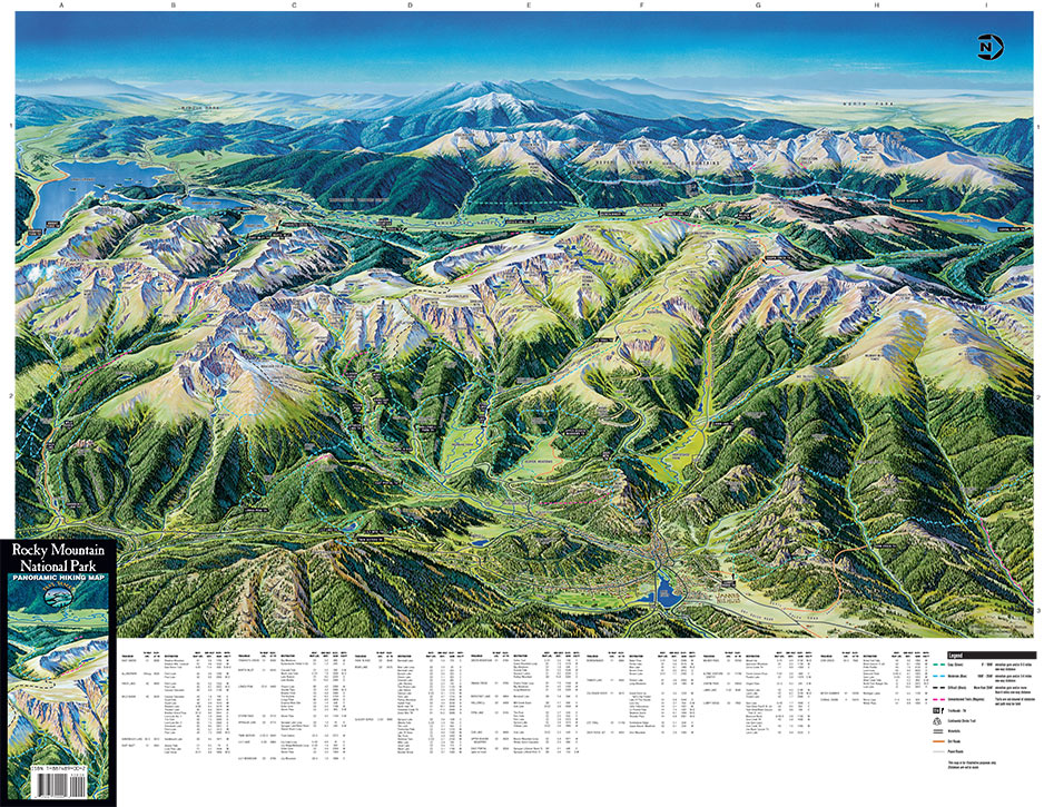
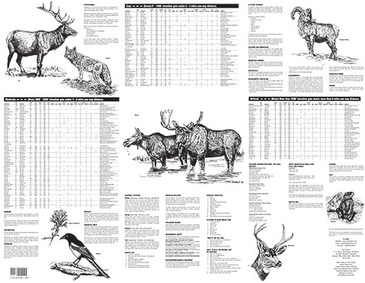
The reverse side of each map provides reference data for each trail including distance, elevation gains, and ecosystems encountered (streams, waterfalls, summits, passes, wildflower timing). Additional information is provided on wildlife, general safety, weather precautions, regulations and permit requirements.
ADD MAPS TO CART
Nearby Cities/Attractions:
Estes Park, Grand Lake, Ft. Collins, Loveland, Longmont, Boulder, Longs Peak, Indian Peaks Wilderness
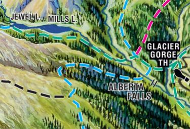
Featured Hike: Mills Lake
Featured Hike:
Destination: Mills Lake
One-Way Distance: 2.9 miles
Elevation Gain: 700′
Difficulty Level: Easy (less than 1000’ elevation gain and less than 3 miles one-way distance)
Trailhead: Glacier Gorge Trailhead (TH)
Elevation at TH: 9000′
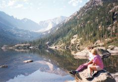
Mills Lake
Trail Features:
This trail passes Alberta Falls which is a great “stop & look” spot. A short uphill climb is worth the reward when Glacier Gorge opens up to Mills Lake. Longs Peak, Keyboard of the Winds, Pagoda Mountain & Chiefs Head provide a spectacular frame for this mountain lake which offers several large flat boulders for being at the water’s edge. If the lighting is just right, a reflection of Longs Peak can be captured on the lake’s surface.
Mills Lake is beautiful in the fall as well as a favorite snowshoe destination in the winter.
Optional Destination: Jewel Lake is just beyond and Black Lake is 2.2 miles further.